While browsing the Web one lazy Saturday afternoon, I happened upon a list of the most beautiful places to visit in the U.S. All the usual suspects were among them: Yosemite National Park, the Maine coastline, the Florida Everglades, etc. But among the items on this list was one I had never heard of: Big Bend National Park in Texas.
I scrolled past the photos, and then took a second look. Beautiful! What is this place? Mountains, desert, river, canyons, wildlife, blue skies by day, black skies at night, and promises of fantastic views of the Milky Way. I started down the rabbit hole of the internet and found more images and descriptions encouraging me to visit. I was intrigued. By the next day, Geoff and I had decided to go.
With airline tickets, lodging, and car rental reservations in place, we turned to planning the details of our trip. I bought a trail guide and paged through it each night, fantasizing about our upcoming trip. I searched websites about hiking, and researched what I would need to bring to the desert to be safe and comfortable, and to truly enjoy the experience.
Anticipation is keeping me wondering
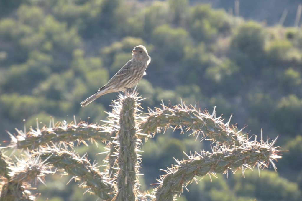
I learned that Big Bend National Park is teeming with wildlife, and I wanted to see it all. Coyotes, foxes, deer, jackrabbits, javelinas, bears, mountain lions, scorpions, tarantulas, snakes, and more than 400 species of birds. I couldn’t wait to experience these beautiful creatures in the wild.
As the weeks passed, all of my free thoughts focused on our trip. I read voraciously about what I could expect to see there. There was a lot to look forward to, but there was also a lot to be afraid of. My worst fears of this isolated part of our country were bears, scorpions, and mountain lions. Especially mountain lions.
I had read that I would not likely see any scorpions, unless I were to look under rocks or logs, which is where they spend 99 percent of their lives. Safe in the knowledge that I wouldn’t be picking up rocks and logs, I breathed a sigh of relief and turned to my other two (bigger) fears: bears and mountain lions. Bears generally leave humans alone, although you need to be a little more cautious if there is a cub around, as the mothers can be unpredictable when protecting their offspring. I read that mountain lions are pretty elusive, and it would be unusual and serendipitous to see one. Although both bears and mountain lions generally stay away from humans, if they do become aggressive, the literature advises you to make yourself as big and loud as possible, and if they persist, throw rocks at them… Wait, what about the scorpions under those rocks????!!!
As anticipation grew, my fears became more distorted. I actually woke up one night wondering why we had decided to visit this scorpion- and mountain lion-infested place. But we were already committed. These were just fears of the unknown, as I would learn once we got there.
Our arrival
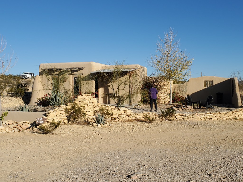
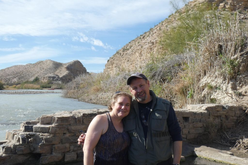
From Boston, we flew to Houston, then took another plane to Midland/Odessa Airport (oil country), then picked up our rental car and started our 4-hour drive in the dark to Terlingua, Texas, where we had reserved an adobe cabin called Casa Piedra (house of rocks), which would be our home for the next several days. Casa Piedra was artfully designed. It was clean, simple, comfortable, and welcoming.
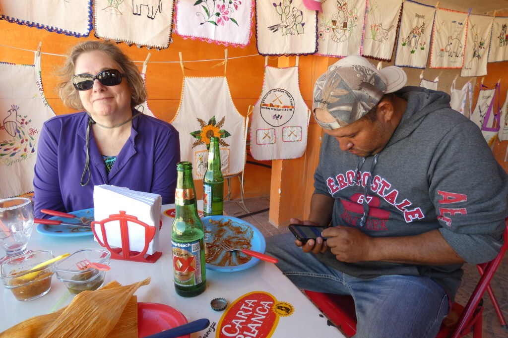
Before we arrived at Casa Piedra, we decided to get something to eat. We stopped at the Starlight Theatre in Terlingua, a well known restaurant and bar that boasts of live entertainment seven days a week. It was clearly a very popular place, since it was almost 9:00 p.m., and we were told we would need to wait 30-40 minutes for a table.
We stood on the porch with a drink in hand and chatted with some of the local patrons, who all appeared to have brought their dogs with them. There were at least a dozen mostly well behaved dogs wandering the parking lot and lying on the large farmer-style porch waiting for their people. They all had an innate understanding that they were not allowed inside the restaurant, so they patiently waited outdoors as a cohesive, somewhat mouthy pack.
One person, who was a self-described local, asked us when we had arrived here in Terlingua, and when we responded that we had just arrived minutes before, she said with a gleefully mysterious tone, “So you came up in the dark….you will wake up to quite a surprise in the morning.”
Day One: Taking in the park by car
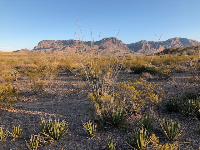
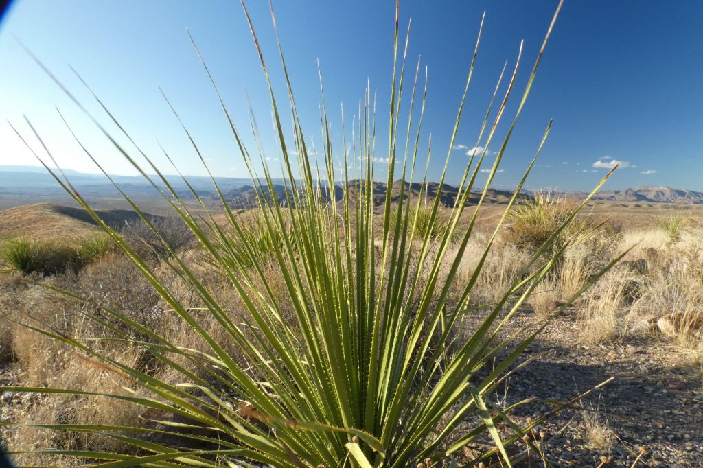
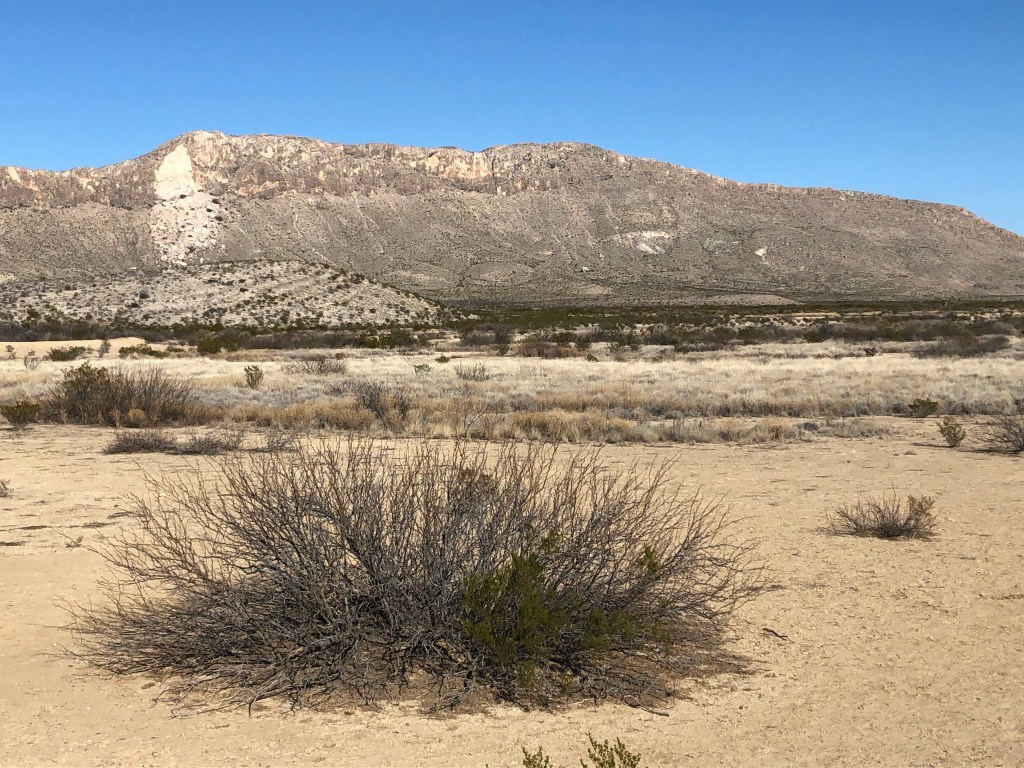
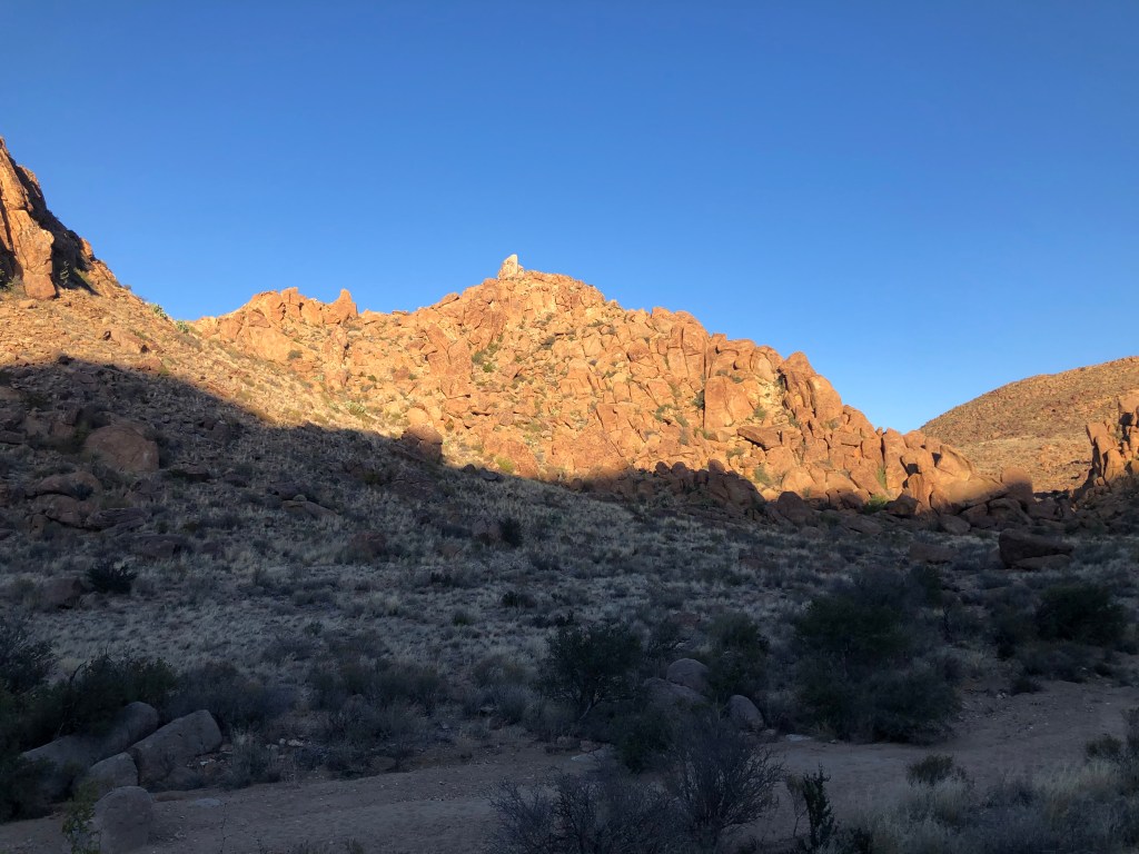
Our buddy from the Starlight Theatre was right. We woke in the morning light and discovered that the plains dotted with oil wells that we drove through in Odessa at dusk had disappeared in the darkness and had given way to a sculpted land of mountains and desert in every direction, punctuated by agave, creosote, sotol, prickly pear, and other desert flora. It was fascinating and beautiful, and the photos that I saw from my months of research didn’t come close to conveying the expansiveness and awe-inspiring views in front of us.
Our first day in the park was Martin Luther King Jr. Day, and entrance to the park was free! The ranger at the station handed us a map, which turned out to be an important tool in finding our way around. Big Bend National Park contains more than 1,200 square miles of undeveloped land. Given the size, we needed to understand what this park was all about before we could concentrate on specific areas. On the first day of our visit, we scoped out the park by car, driving from one scenic vista to another.
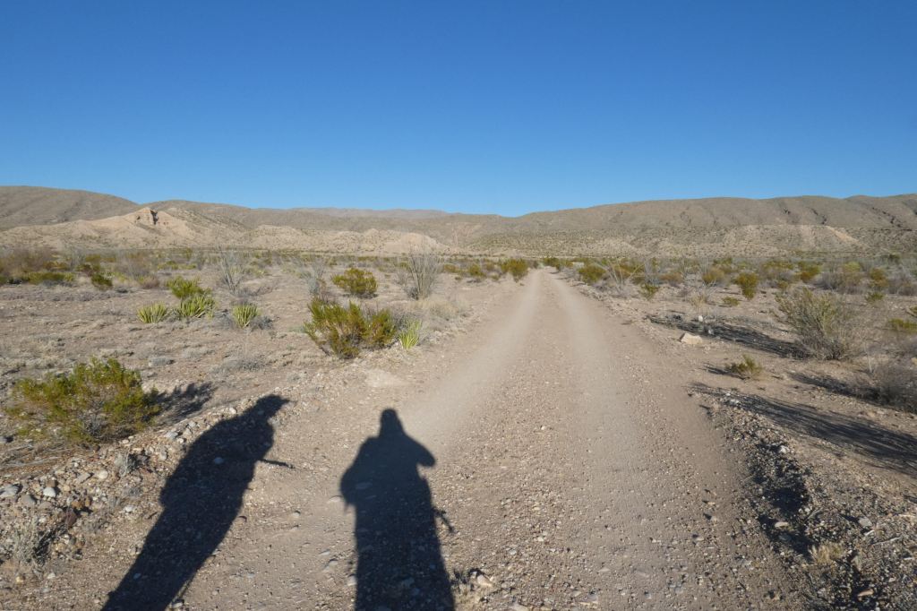
Our first stop was up Old Maverick Road, a dirt road that runs at least 20 miles. It is rocky, sandy, and narrow. I recognized right away that my decision to splurge on a 4-wheel-drive SUV was a good one.
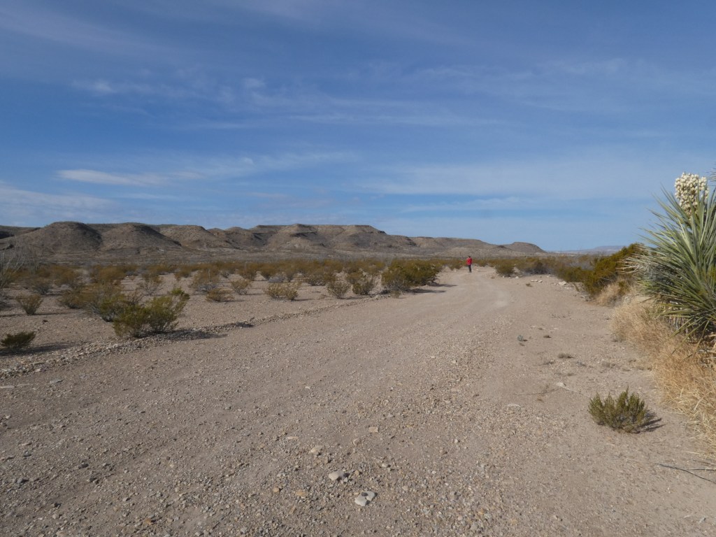
Old Maverick Road
We stopped several times on Old Maverick Road, as well as other locations, to wander a few hundred yards from our vehicle and take in the beauty and silence. The silence for this East coast suburbanite was especially notable. I would hold my breath and stand still so I could take it all in. No road noise, no airplanes, no other people. Just silence. As Geoff and I walked slowly through these first steps into the desert, all we could hear was the crunch of our footsteps. This void of any sound will stay with me for a long time as one of the most cherished elements of our trip.
Day Two: River adventure on the Rio Grande
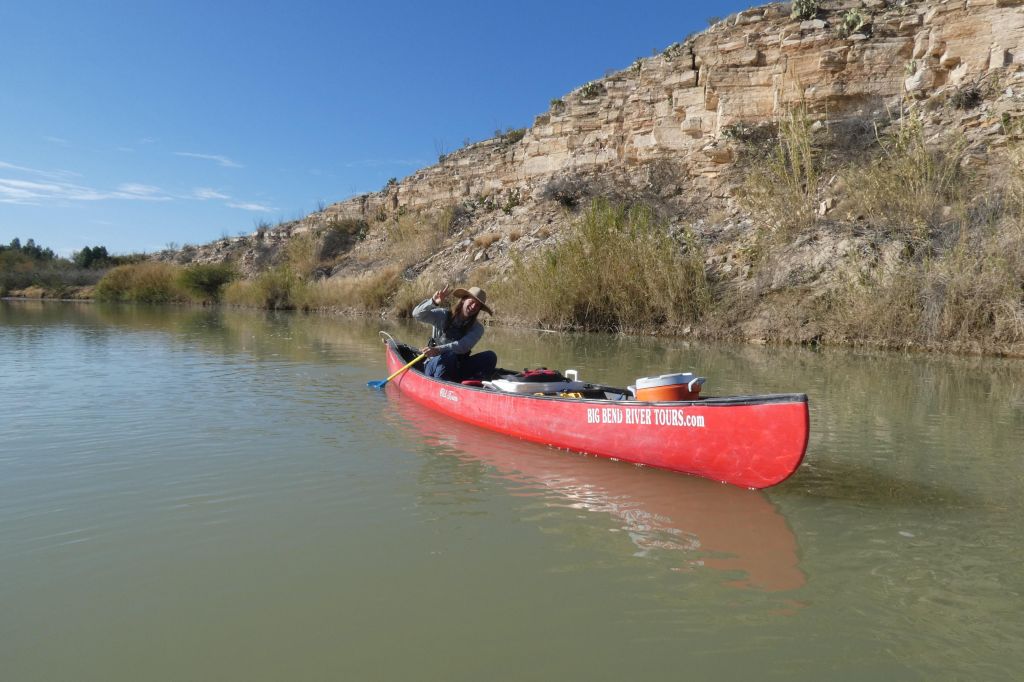
We met our guide Eric at Big Bend River Adventures at 7:45 a.m. Eric is a very intelligent, articulate 30-something with long blond hair and a love the for the outdoors. He is very knowledgeable about local geography, history, geology, plants, and wildlife. Eric regaled us with interesting facts about the area during the long ride to the Rio Grande, where we would start our canoe trip.
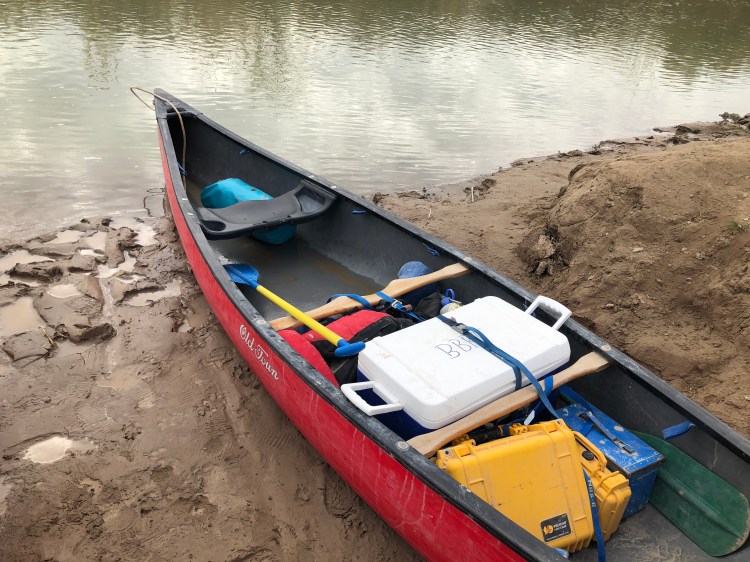
When we got to the the river’s edge, we received the requisite safety lecture, then donned our life jackets, and headed toward the canoe that Geoff and I would share. (Eric had his own canoe, which also held the provisions for the trip.) Before I could lift my first foot up and into the canoe, both feet slid into the silt, and my largest muscle landed on the muddy bank. No harm done, but it was a bit embarrassing to wear a badge of mud on my back side for the rest of the day.
We paddled on the slow-moving river for a couple of hours, sometimes backwards, sometimes sideways, and occasionally the right way. The river at this time of year is gentle and shallow. At the beginning of our adventure, Eric told us that if for some reason we were to capsize, we should just stand up and laugh at ourselves, since often the river is only knee-deep.
After a couple of hours, we took a break from the river. Eric led us on a trail hike that overlooks the Rio Grande and features a hot spring. It was at the hot spring that we met a few other people, including a couple from Seattle who had rented out their home for a year so that they could travel the country. It turns out that there a number of people who do that, and Big Bend National Park obviously makes it onto their itinerary.
Eric suggested that we continue to enjoy the hot spring and trail while he ran ahead to prepare our lunch. A few minutes later, we caught up with Eric standing at a picnic table that had been covered with a wide array of lunch items, including among other things, smoked oysters. Eric was wearing an apron that had been purchased when his tour company hosted one of the Bush daughters a few years back. The table linens and apron were attempts to make a hospitable impression on the former president’s family. Eric conceded that the other tour companies in town have poked fun at the aprons ever since.
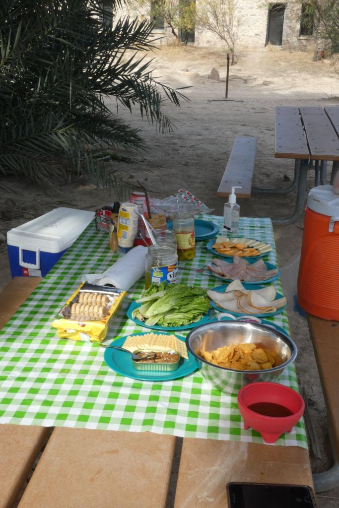
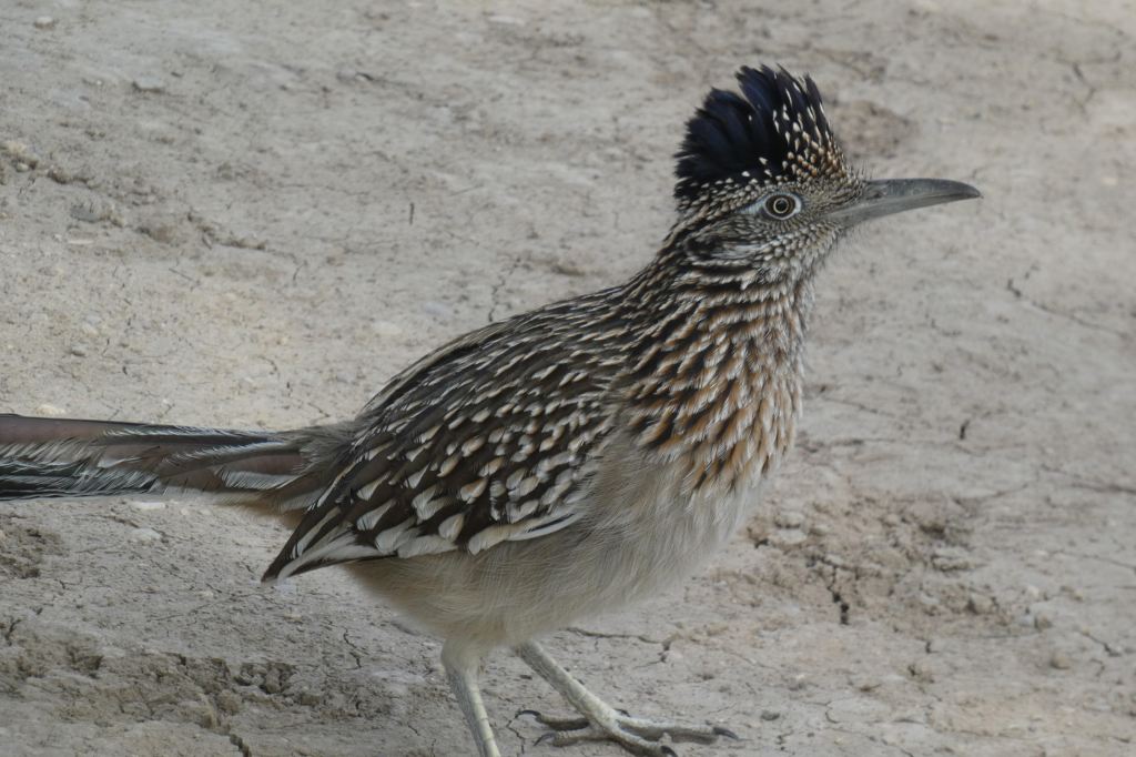
We enjoyed our lunch as we made friends with a persistent roadrunner who was hoping for a few morsels. As known “vicious predators,” I am sure he would have relished the oysters, but it would have been wrong to give into his pleas.
After lunch, we continued our canoe run down the Rio Grande, at times stopping our paddles to take in the majesty of the canyons and the silence. The canoe trip ended too soon, and we headed back in Eric’s truck to Terlingua. On the ride back, Eric mentioned that the real fun is in multi-day river trips. I put that thought into storage for another time. Sounds wonderful!
Day 3: The Window
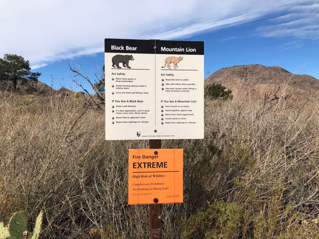
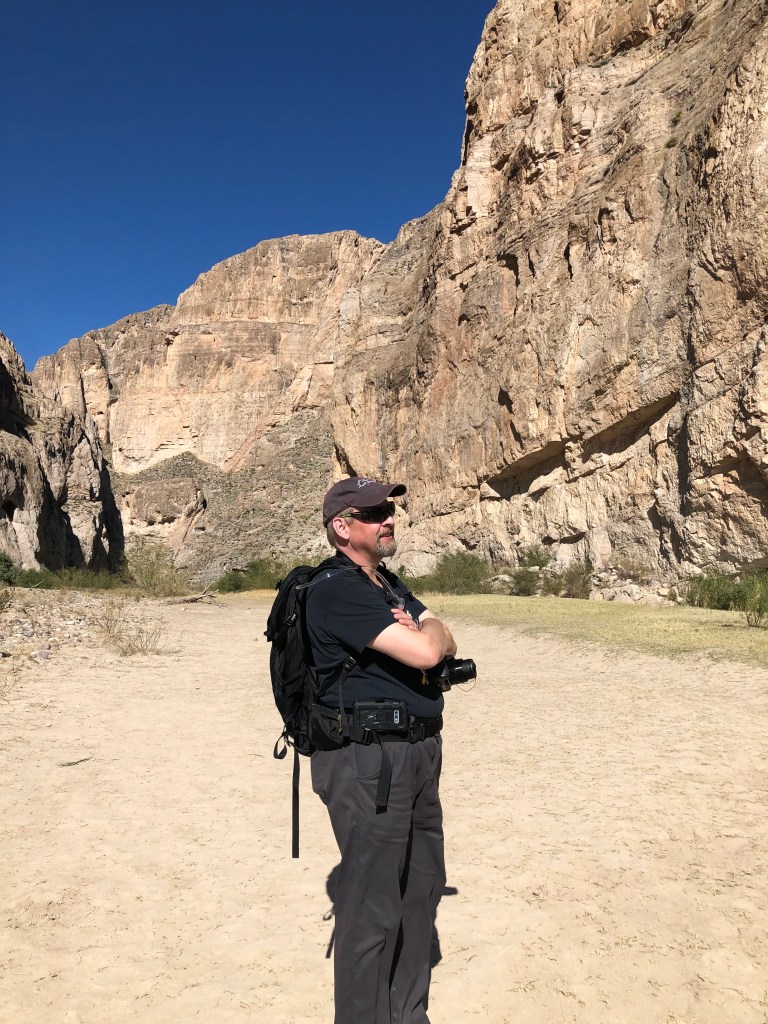
Our first day hike at Big Bend was the Window Trail. The guide book states that it is 2.8 miles one way, and like most trails at Big Bend, you simply reverse your direction to return to the trail head. The Window Trail is in the Chisos Mountains. It is a popular trail, but it was hardly crowded. We probably ran into other hikers every 20-30 minutes, but were otherwise alone. A sign warning us of bears, mountain lions, and extreme fire risk was on display at the trail head.
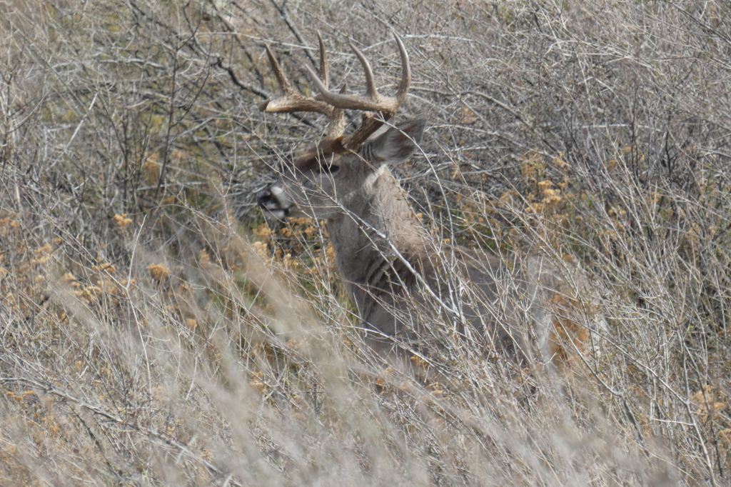
Also at the top of the trail was our first sign of wildlife: two bucks standing close to the parking lot, posing for photos. One woman was standing just six feet away, staring at one of the bucks through the lens of her camera. We took pictures too (of course), but courteously used a zoom lens rather than invade their personal space.
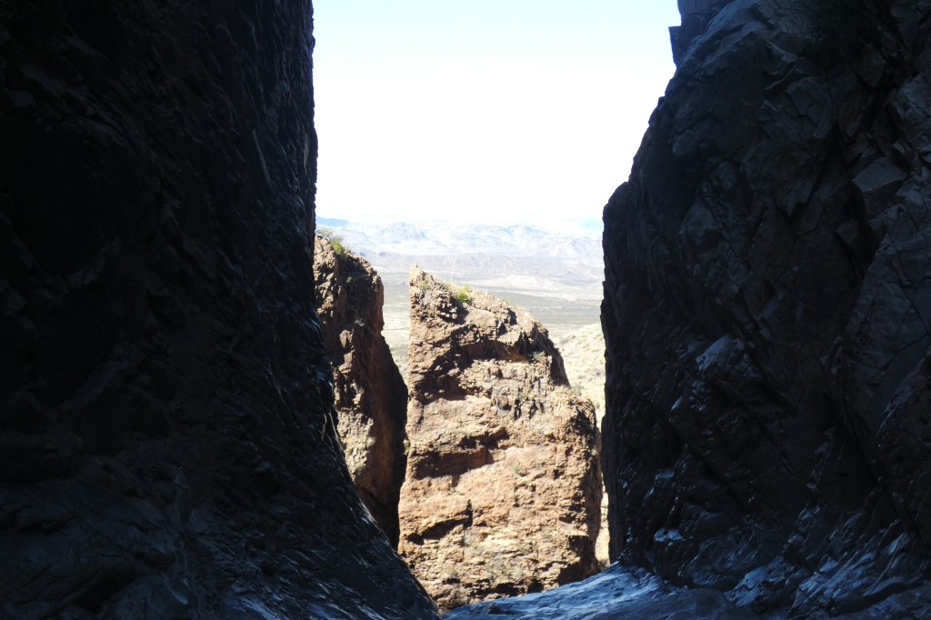
The trail was long. We hiked downhill for 2.8 miles, dreading the return trip, which would be uphill for the same 2.8 miles. We were treated to stunning views of mountain peaks in every direction against deep blue skies and green leaves, a colorful contrast to the lower desert floor. The trail ends at a rock formation in the shape of a window that reveals a panorama of canyons and desert plains below. The window is at a precipice, so we didn’t get too close to the edge. After we had our fill of this view, we turned around to start our hike back to the top of the trail.
At about a third of our way back to the trail head, Geoff stopped suddenly and pointed to two black bears, a mother and her cub, standing in a dry stream bed to our right, about 50 feet away. We knew the drill: make noise, don’t run, and don’t panic. But the panic instinct kicked in pretty quickly, at least for me. I’m not sure what I looked like on the outside, but inside, my heart rate seemingly tripled as I remembered that bears have a keen sense of smell and that I was carrying a ziplock bag filled with trail mix in my backpack.
We backed up and weighed our options. We could go back toward the Window, or we could continue forward. The cub was closer to us and regarded us with curiosity. Geoff tried to take a quick photo, but he wasn’t able to focus the camera on the cub and his attention on the protective mother at the same time. Below is the photo he took of the bears. Enjoy.
Self-preservation won, and we decided to walk, not run, loudly and with purpose toward the trail head. After a few hundred feet, we allowed ourselves to bask in the relief of surviving our first (and so far only) bear encounter.
About a quarter mile beyond that dry stream bed, we met a father and his nine-year-old child who were hiking toward the window. We warned them that we had seen two bears in the direction they were heading, and the child reacted with excitement and enthusiasm at the prospect of encountering them. We continued to celebrate our good fortune of getting through the bear encounter without harm, and eventually relaxed enough to enjoy the rest of our ascent to the top of the trail. (We saw the father and child two days later, fortunately still in one piece.)
At the end of our hike, Geoff dutifully reported the bear sighting to a ranger. The ranger responded, “Oh yeah, they hang out in that stream bed all the time.”
Day 4: Boquillas, Boquillas Canyon, and Old Ore Road
Boquillas Village
With all of the national and political dialogue about the “Border Wall” these days, I was expecting to find an imposing barrier, razor wire, and humorless agents at the border checkpoint. To my delight, I found the Boquillas Crossing Port of Entry to be almost charming. It is a small, welcoming plaza and the surrounding grounds resemble a park. We entered the main foyer, and were greeted by a cheerful U.S. Customs and Border Protection agent who asked what we would like to do. Puzzled as to what options we might have, we responded that we would like to cross the border into Mexico and visit Boquillas.
To cross the border, we were required to pay a $5 per person entrance fee. The fee covers the round trip travel by rowboat across approximately 50 feet of the Rio Grande.
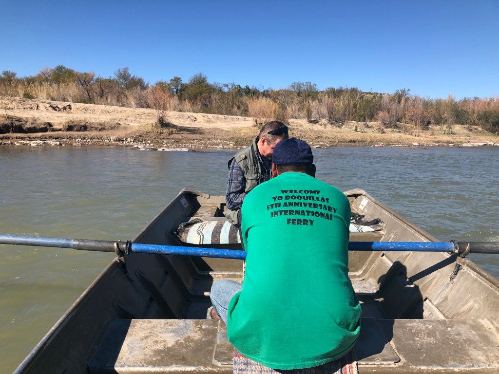
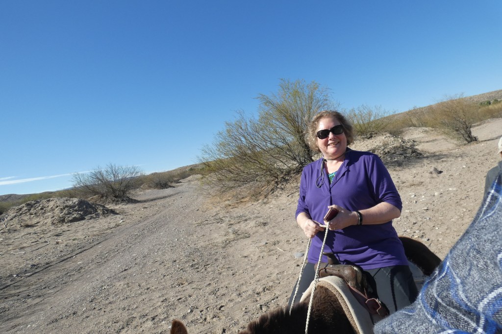
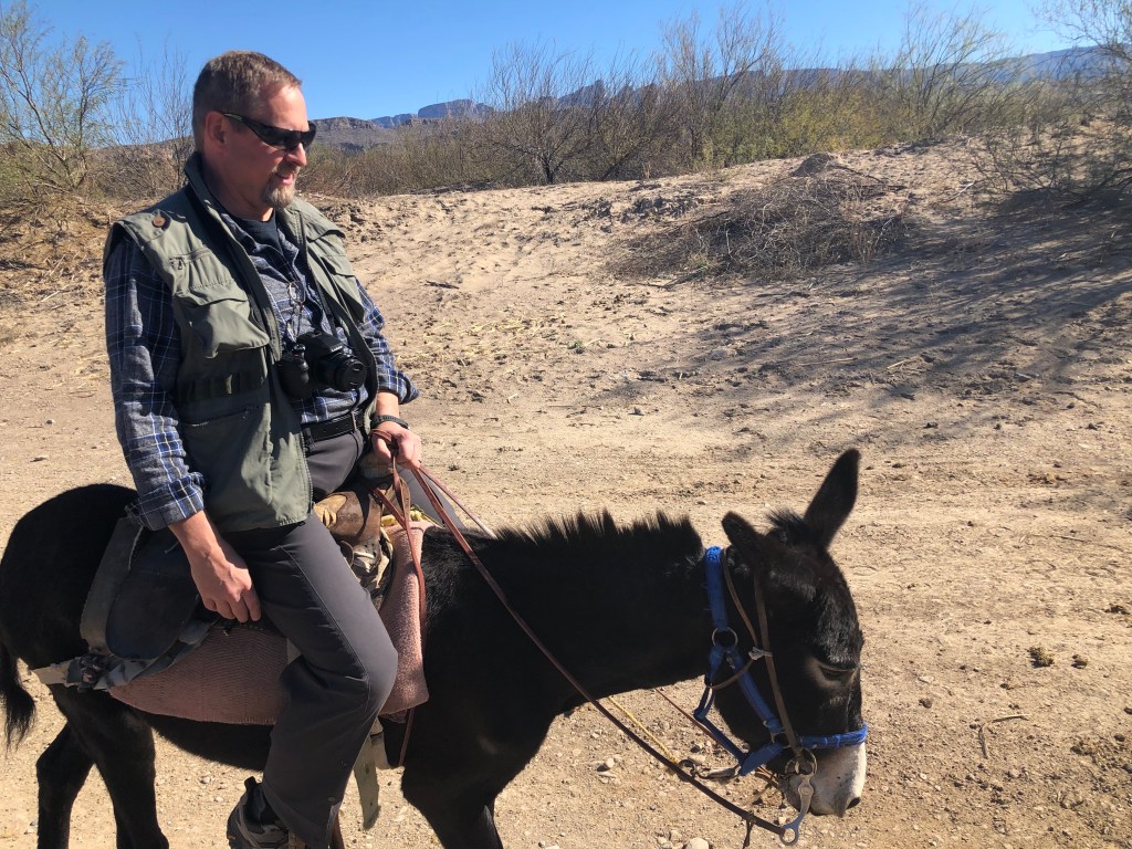
On the Mexican side, we were greeted by an earnest and friendly guide, Vincente, who asked if we would like to travel by horse, donkey, or foot. We of course chose to travel by donkey.
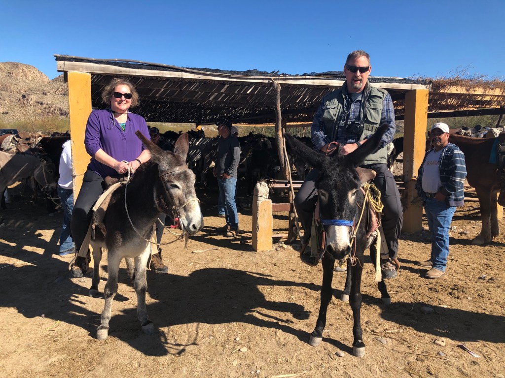
Vincente helped us onto our respective donkeys, and then made kissy noises behind us to signal our donkeys to begin their half-mile journey to the center of the village. Vincente walked behind us, guiding our donkeys who could navigate the trail well on their own. Both donkeys competed for first position on the route, and the trailing donkey would trot forward to pass. These two donkeys leapfrogged all the way to our destination jockeying for position in spite of the two inexperienced riders on their backs.
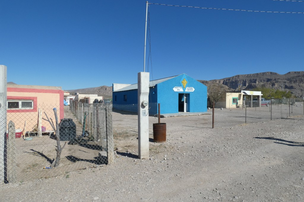
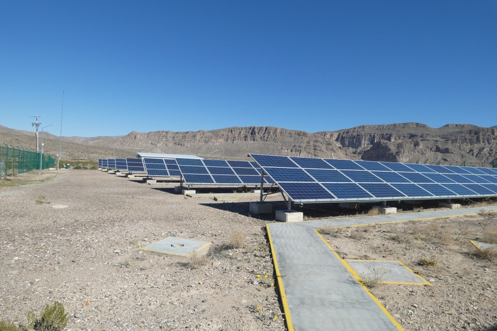
At the edge of the village center, we dismounted our donkeys with Vincente’s help, then Vincente began a walking tour of Boquillas Village. His first stop was to his wife’s souvenir stand. She stood behind a display of her embroidered cloths and handmade trinkets and smiled as Vincente introduced us. We bought a few items, then Vincente continued his tour, proudly pointing out his own home, the school, the church, the hospital, and the solar station that provides electric service for the entire village of roughly 240 residents.
Vincente suggested that we have lunch at Boquillas Restaurant. There are two restaurants in the village, and Vincente felt this was the better of the two. The proprietor confirmed this fact, and offered us “the best margaritas,” “the best enchiladas,” and “the best tamales.” Later, he also sold me a couple of bottles of “the best vanilla extract,” which is a specialty of Boquillas.
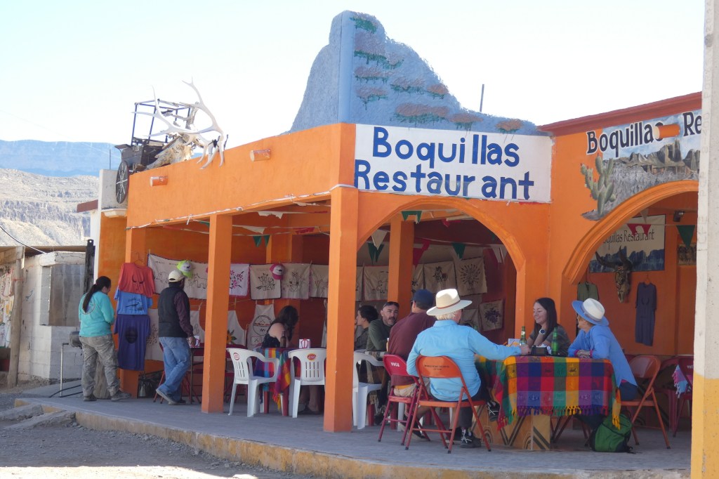
We invited Vincente to join us for lunch. He happily accepted, but in doing so, he had to withstand some gentle ribbing from his fellow guides who were sitting in the back of the restaurant while their clients ate their lunches sans guides.
The enchiladas and tamales were excellent and authentic, the margaritas were refreshing. I have not yet sampled the vanilla extract.
After our visit to Boquillas, we traveled back by donkey to the river’s edge, and took our rowboat (international ferry) back to Boquillas Crossing Port of Entry.
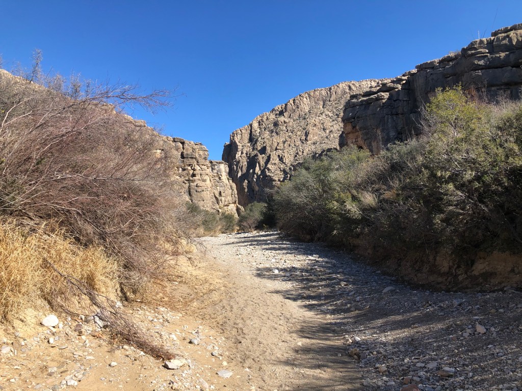
Boquillas Canyon
There were still many hours of daylight left after our quick visit to Boquillas, so we next drove to the Boquillas Canyon trail, which is along the Rio Grande on the American side. We parked the car and headed up a steep path. Along the way, we met a man who was returning to his vehicle. He whispered as he passed that when we reach the canyon, we would meet “Mexican Jesus.” We nodded in acknowledgement.
The trail moves up to a summit, and then down again toward the river. It was mid-afternoon, and the sun was warm, but not hot. Perfect hiking weather. As we rounded a bend near the river, the dulcet voice of Mexican Jesus wafted in our direction. A few more steps along the path revealed the man whose songs welcomed us before he could. He was slight in build and cheerful. He asked if we liked his songs, and offered to dance for us. Geoff spoke for both of us, stating that we would stop on our way back out of the canyon.
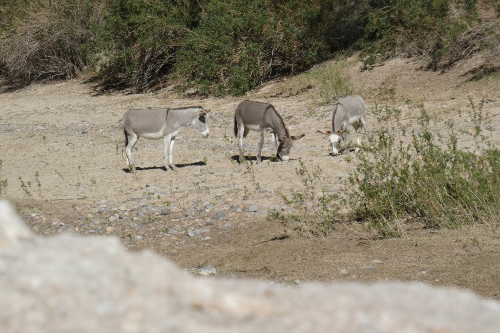
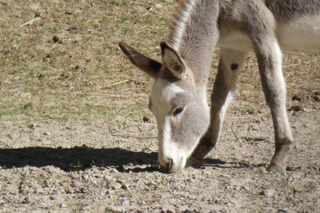
The trail wound around the shape of the river into Boquillas Canyon. We noticed some burros on the far side of the the river grazing at its edge, and wondered if they belonged to the man we knew as Mexican Jesus.
The canyon was calm and peaceful and indescribably beautiful. There were many caves high above the ground that had been carved from the rocky walls by the the mighty Rio Grande millions of years ago. During our visits to various canyons, we often wondered who might be living in the caves we spotted. In some cases, thousands of years ago, they had been the homes of people. In other cases, presently or previously, they might have held mountain lions, bears, bats, or other animals. It was fun to play the who-lives-here game, but we would never really know for sure.
Upon our return from the canyon, we once again ran into Mexican Jesus. He cheerfully approached us and encouraged us to buy some souvenirs from the small stand he had laid out by a boulder. When we responded that we were all set for souvenirs, he asked Geoff if he had any protein bars or trail mix. Unfortunately, he did not. Our new acquaintance then turned to me and asked the same question. I looked at him a little more closely, and noticed that he was actually quite thin. We realized at that moment that he wasn’t just a colorful feature of our journey to entertain us; he was hungry. Geoff and I both ached inside knowing that we were not able to provide him with even a morsel of food, a basic human need. I replied that I didn’t have any either. He cheerfully accepted the situation and began singing again as we walked back to the trail head.
Old Ore Road
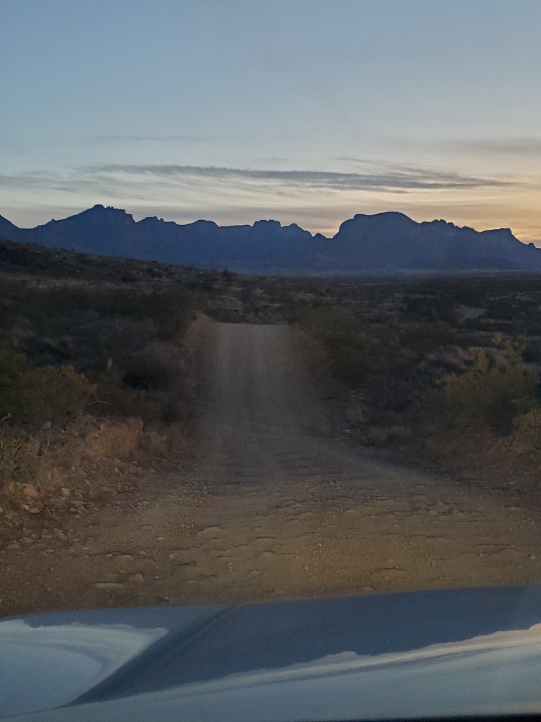
We had just enough daylight to take in one more short, easy trail. A quick check of our guide book showed that the trail to Ernst Tinaja was only half a mile long and promised stunning views. According to the guide, Ernst Tinaja is just six miles down Old Ore Road, which we would pass on our way back to Terlingua. The sun was getting lower in the sky, but this should be easy. We turned onto Old Ore Road and discovered that it was a narrow, rough dirt road that made Old Maverick Road look like a superhighway.
Six miles of rough, bumpy driving on Old Ore Road (about 30 minutes) brought us to the trail head. The views at this time of day are bathed in golden light. I looked closely out of the side window of our car, knowing that this time of day brings out wildlife. I was hoping to catch a glimpse of some javelinas grazing by the brush along the side of the road. Javelinas, also known as collared peccaries, look like small wild pigs, but are a different species altogether. They are common in the area, but shy, and prefer to roam between the hours of dusk and dawn. We had seen a few javelinas flash by at the side of the road on other days, but none were seen as we raced our vehicle down Old Ore Road at a whopping 10 mph.
When we finally emerged from the car at the trail head, we noticed a familiar sign warning hikers of bears and mountain lions. It gave me pause. Geoff and I walked a few hundred feet down the trail. I found myself stopping frequently and looking behind me and off to each side. Bears were not a problem. I had seen those and survived. Mountain lions, on the other hand, were terrifying, the apex predator of the Southwest. I was convinced that mountain lions were lying in wait in caves, on top of boulders, under shrubs, poised to silently pounce on us if I were to avert my eyes. That same silence I was growing to cherish heightened my fears.
I kept walking, but the stops became more frequent. Moving forward was becoming more difficult. Geoff, picking up on my anxiety, tried to persuade me to continue, but I just couldn’t. We finally turned around, and I looked over my shoulder all the way back to the car.
I apologized and regretted my decision to retreat. Even though there are warning signs, it is highly unlikely that we would have run into any wildlife at all on foot. Mountain lions are not common. They do not like to engage with humans, and if there were any along the trail, which is only a remote possibility, they would have stayed hidden or left the area. I hope I have another opportunity to visit Ernst Tinaja.
By the time we got back to the car, the sun was setting. We began our six-mile return drive on Old Ore Road. A couple of miles into our return, just before cresting a hill on this narrow, dusty road, we encountered a car traveling downhill toward us. There was only room for one vehicle on this hill, and we had reached a standoff. There was nowhere to go. Finally, Geoff put the gears in reverse, and artfully navigated the contours of this road about 100 yards, until he was able to find a space that might be wide enough to hold two vehicles. I swiveled the passenger-side mirror inward to create another couple of inches of space and the opposing vehicle slowly drove toward us.
The other car rolled to a stop beside us. The passenger lowered her window and thanked us for making this work. “I didn’t know what we were going to do,” she said, with over-the-top emphasis. She mentioned that they were on their way to a campsite just a few miles down the road, and asked about road conditions. I said that they would be fine. Geoff, understandably, grumbled below his breath.
Once the car passed, I moved the side mirror back into position, and we continued on to the top of the hill. Just a few feet beyond the original location of the other car, we noticed a very wide turnout that would have easily allowed both cars to pass. We rolled our eyes and drove back to Terlingua for the night.
Day 5: Dog Canyon and Grapevine Hill Trail
Dog Canyon
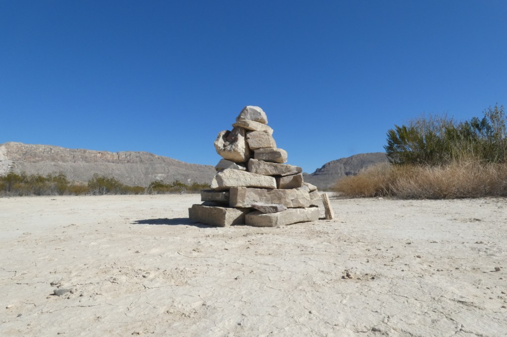
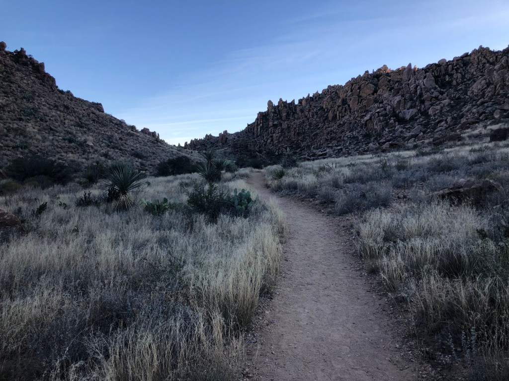
Dog Canyon leaped out as a good option for our last full day at Big Bend. It is 2.5 miles (each way) along the desert plain, so no real hills to conquer. In addition, the trail is very easy to follow because the canyon is visible from the road, and the trail is marked with many cairns.
Dog Canyon is so named because of a story from Big Bend’s early ranching period. An abandoned oxen-driven wagon was discovered here guarded by a dog. Although the owners of the wagon were never found, as the trail signs states, the dog now has a canyon named after it.
The trail sign also mentioned that hikers should avoid this trail during the summer at noon because of the dangers of heat and dehydration. Even in January, I could see that the admonition would be important.
The landscape changed over the course of our hike. Sometimes, we traveled through open sandy desert floors, and other times, we pushed through brush that was just wide enough for a single person to pass. Birds called out and perched on top of desert plants. It was easy to see why birding is a fun activity in Big Bend. Their calls penetrate the silence, and the barren landscape makes viewing easy.
The canyon itself was cooler than the desert floor that preceded it. It was shaded, and contained many caves like those we saw in other canyons. We enjoyed the shade and spent some time in self-reflection as we trudged back through the canyon and desert wash.
Upon return to the car, I pulled off my backpack and realized that it had been completely soaked by perspiration. Even in January, this was a hot place.
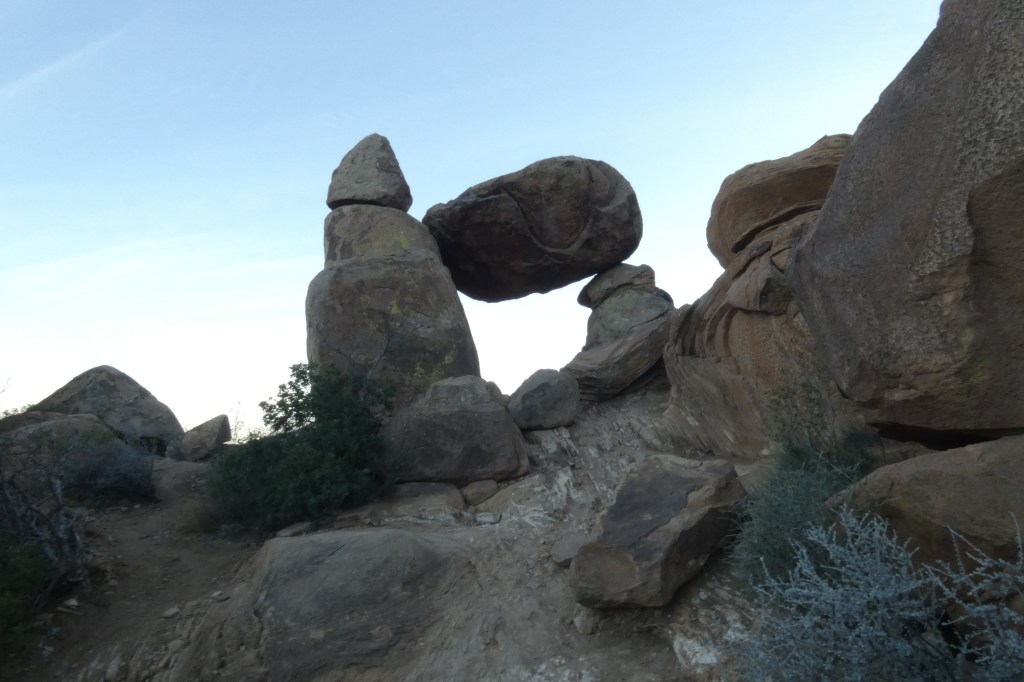
Grapevine Hill Trail and Balancing Rock
The last trail for our trip was Grapevine Hill Trail, which ends at Balancing Rock. This is an iconic landmark at Big Bend National Park. It is marked as an easy trail, except for the last 100 feet or so, which is a rock scramble. It is a very popular trail, and we were warned that parking might be difficult to find. When we arrived, we found the last space in the lot.
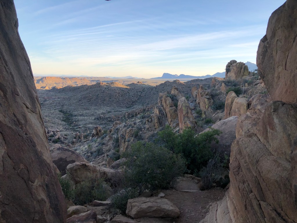
We arrived in the late afternoon, which turns out to be the best time to take in this particular trail. The setting sun warms the color of the rocky walls to a soft orange hue. The plants are so perfectly positioned that it looks like someone planned this. Grapevine Hill Trail is like walking into a desert garden.
Shortly after the start of our trip, a woman wearing what looked like a wedding dress emerged from the trail. Behind her was a well-dressed man carrying a large leather bag. Looks like a photo shoot. Maybe a bride, maybe a music video, or maybe for a model’s portfolio. She was radiant. Without explanation, she silently sauntered off the trail with grace and a smile, leaving all passersby to guess. I performed a mental comparison between her immaculate dress and my sweaty clothes, dusty boots, and heavy backpack, and rationalized that she was the one who seemed out of place.
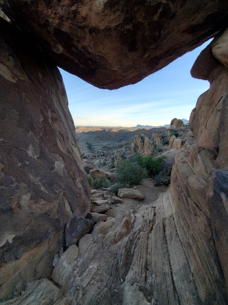
This was perhaps the prettiest trail I had ever seen. It was a good one to end on. We moved up toward the rock scramble and Balancing Rock. It was challenging at the end of the day, but we made our way up to the prized lookout. We gazed through the window that was created by the balancing rock and onto the plain below. Everything was washed in that glowing orange light.
It’s pretty steep at the top of the rock scramble. As Geoff tried to take a photo in front of the balancing rock, two men appeared out from behind the rock and apologized for startling us. I thought we had been alone.
They mentioned that they had been to this place many times, and that sunset is the best time to come. They moved along down past the rock scramble, and Geoff and I followed shortly thereafter.
Magnificent. The whole trip was magnificent.
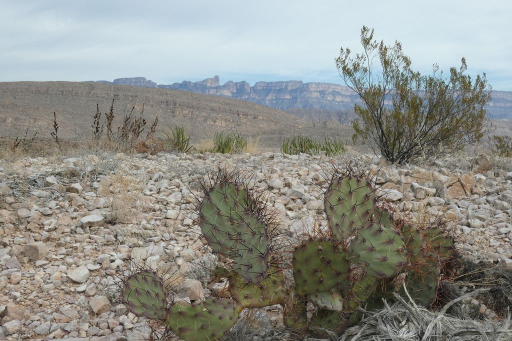
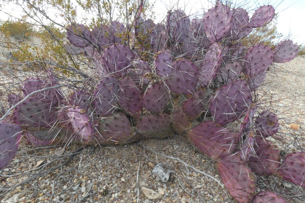
Photo credits go to my dear husband and bear whisperer extraordinaire, Geoff Briggs.
Follow My Blog
Get new content delivered directly to your inbox.
